Monthly Archives: December 2024

The Equator – What a SCAM!

I’ve crossed the Equator twice now, once southbound more than 2 years ago and northbound again yesterday.  You’d think there’d be a big dashed line like you see on globes and world maps but nope, nada!  In the old days, before GPS, we would mark our position by painting a spot on the water. Alternately, you could paint a spot on the side of the boat. Either way, you’d know one thing or another.

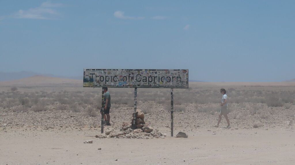
Of course, nobody precisely knows where equator is because zero degrees latitude (the Equator) is a made-up thing. That will come as some disappointment to people who build stone monuments with bronze plaques that say “Dude, you’re standing on the Equator”. I passed a sign by the gravel road in Namibia that said “Tropic of Capricorn” like they knew where it was. Trust me, Henry Miller’s book is way more interesting.

Over the years (centuries), increasingly refined mathematical models have evolved to represent the earth’s surface. The current model is an oblate spheroid (a sphere squished down a bit at the north and south poles) and designated as WGS84. WGS = World Geodetic System. It was preceded by WGS60, WGS72, and others. Of course, every time you change the model the location of the Equator in relation to physical points on the earth also changes.

The WGS84 model and datum are the basis for the latitude and longitude coordinates you get on any GPS device. The various GPS satellite constellations, there are now several, are actually datum-agnostic but WGS84 is the agreed datum they use. So everyone gets WGS84 coordinates and they drive, fly, sail, hike, etc. using them. Everyone is happy, right? Wrong.

The problem comes when you plot WGS84 coordinates on a map or chart that wasn’t drawn using the WGS84 datum and coordinate system. It will show your position in the wrong place. This problem is especially acute with nautical charts which have been drawn over a very long time using who-knows-what datum, map projection, coordinate system, etc.  Modern boats like mine are all equipped with “chartplotters”, fundamentally moving map displays like a satnav map you may use in your car. However, the electronic charts the chartplotter uses are often derived from old paper nautical charts without correcting them to WGS84.

I encountered this problem in Tierra del Fuego. I was motoring through a channel between two islands, pretty much in the center of the channel as I eyeballed it. However, the chartplotter showed my position way off to one side of the channel, almost on the shore of one of the islands. The Pacific is another place where the nautical e-charts can be far off. Through a somewhat convoluted process, tech-savvy cruisers are geo-referencing satellite imagery and loading that into their chartplotters. Not only does it accurately display their boat’s position relative to islands, reefs, sand bars, etc. it also shows other information like submerged coral heads as dark shapes in the water. It seems chartplotter makers should pick up on this data source as a product and make it easy for people to load satellite imagery into their chartplotters. Maybe they’re working on that.

So, if you’re ever at a cocktail party and someone comes up and asks “What’s your datum?” don’t be offended, just say “WGS84”. That will lead to a no doubt thrilling conversation about oblate spheroids, coordinate systems, map projections, datums and the like. You can toss in this factoid: even taking into account the mountains and ocean trenches, the Earth is still smoother than a cue ball! Ha. Or you can just say you’re datum-agnostic and walk away. 
The Equator – yeah, right!

Tropic of Capricorn crossing the Namibian desert.
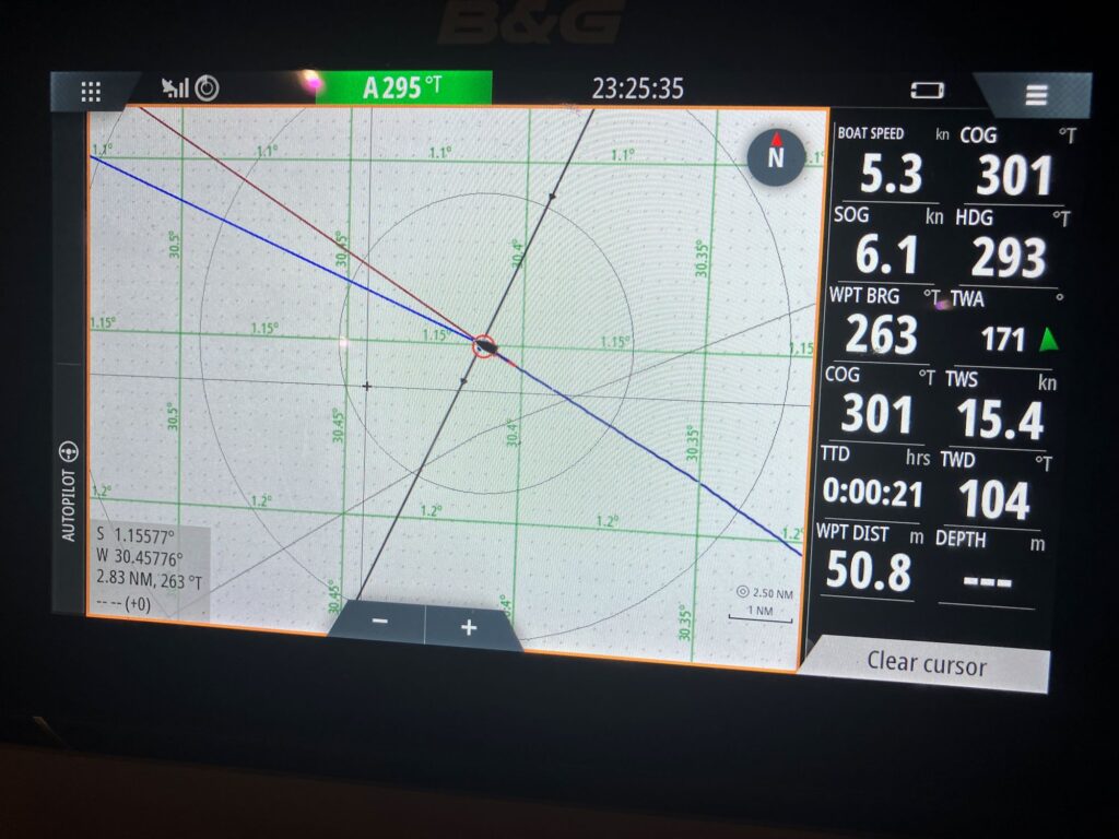
Monday night I crossed my southbound track from over2 years ago.

St. Helena Island

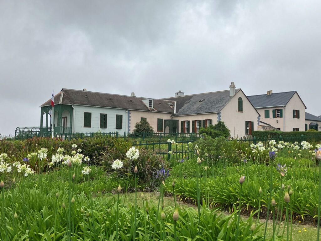
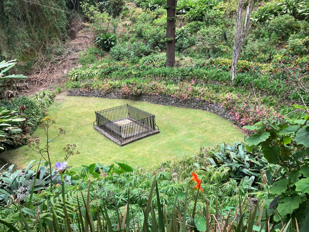
This island is best known as the second exile location of Napoleon, the first exile being on the island of Elba in the Mediterranean which may be best known for the famous palindrome “Able I was ere I saw Elba”. I landed my plane in Elba, which is totally off the topic. Napoleon died on St. Helena in 1821 and was buried there. Through some diplomatic maneuvering, in 1840 the French persuaded the English to let them dig up Napoleon’s tomb and take his remains back to France.  They were re-interred at Les Invalides in Paris where they remain today.

Never inhabited before Europeans arrived, St. Helena was supposedly discovered in 1502 by some Portuguese guy with too many syllables in his name, though some dispute that. Even so, it was in use early on by ships making the journey from Asia back to Europe as a stop for fresh water, timber for repairs and provisions once it was populated with animals. In this way it was similar to La Reunion island I visited this summer, both formed by seamount volcanos. Reunion is much bigger with a population of over 800,000; St. Helena’s population is only about 4,500.  Of course, La Reunion is totally French-fried; St. Helena is tout à fait British. British pounds are used here although there is St. Helena money also in circulation on parity with the pound sterling. It’s hard to understand why they’d go to the trouble and expense of having their own currency which is useless elsewhere. They also have local credit cards which are more widely accepted than foreign credit cards like Visa.

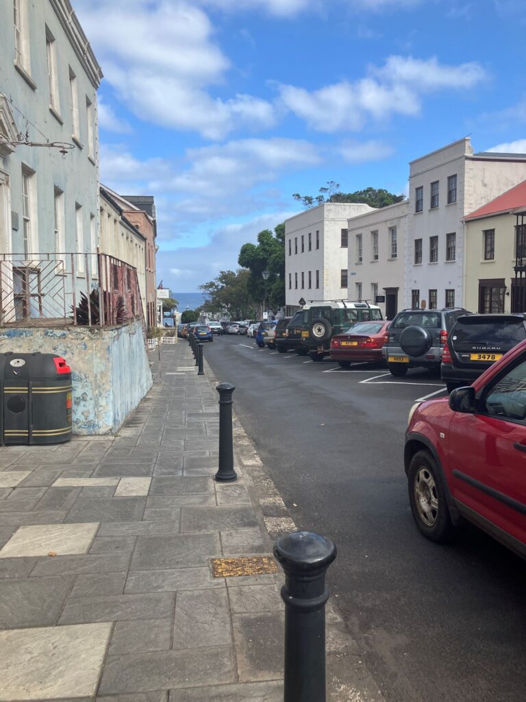
Like Namibia, my AT&T cellphone wouldn’t roam onto the local network but I didn’t bother to get a SIM card; I really didn’t need to call anyone. I can’t remember the last place I was where the phone numbers are only 5 digits and the license plates are 4 digits.

I visited all the Napoleon stuff, of course, and took a tour of the island to get a feel for the place during the 4 days I was here.  It was mildly interesting. Tourists do come on the weekly flights from Johannesburg to visit these places and also swim with whale sharks. Cruise ships stop for a day about once a month.

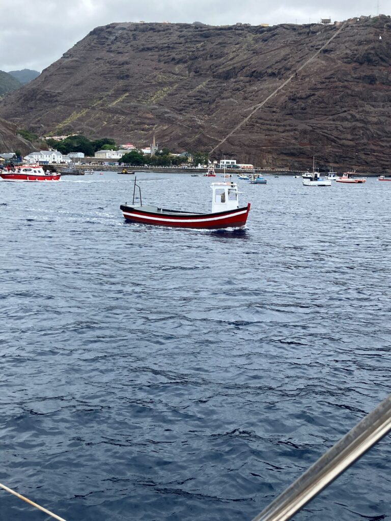
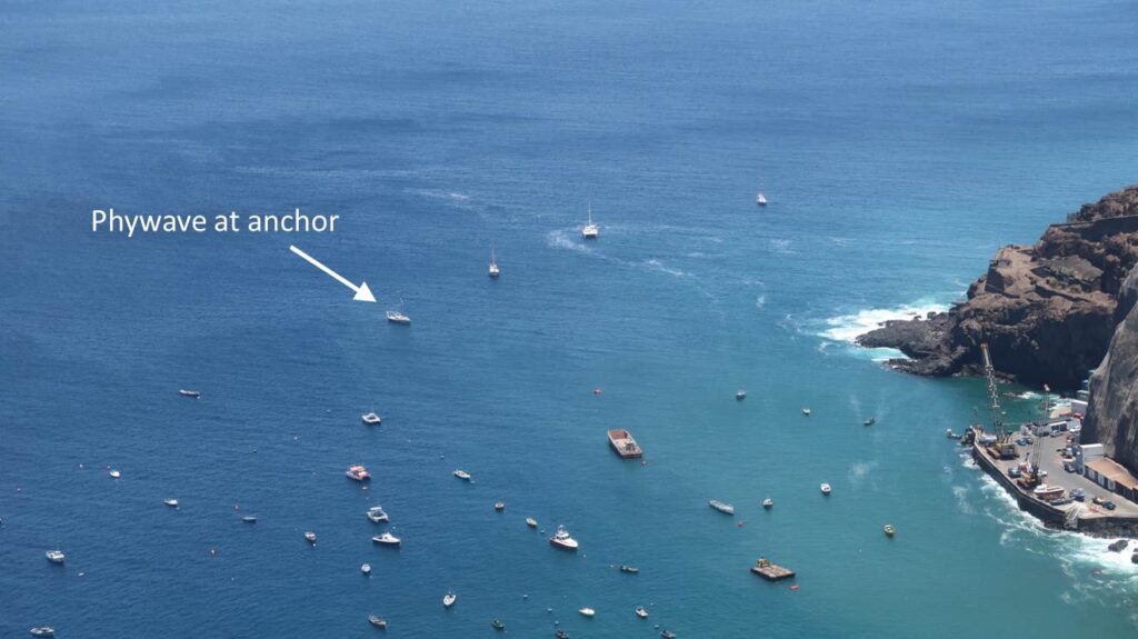
They used to have a popular field of mooring buoys for visiting yachts but they shut it down in January, 2024, because it urgently needed repairs. They say it really needs to be entirely replaced but they don’t have the money to do it.  I had to anchor Phywave in 17 meters of water and let out most of my 80 meters of chain.  The anchorage is not great, pretty rolly. Fortunately they have a little harbour ferry boat that will pick people up from their anchored yachts and take them to shore, 2.50 pounds return, a bargain. 

I did manage to have conversations with a few locals in bars. One guy, a retired fisherman, claimed to have been born on St. Helena and spent most of his life there except for a stint in South Africa. He was slurring his words so I figured he’d already had a lot to drink or maybe he was just talking in cursive.  He told me that sometimes the swells and chop in the harbour get so bad the little ferry can’t operate. That’s great, I thought, I need to ride it at least once more to get back to Phywave. Not wanting to dwell on bad boat stories, we changed the subject and he started talking about his family. “My mother started walking 10 miles a day when she turned 65. Now she’s 93 and we have no idea where she is.” Yup.

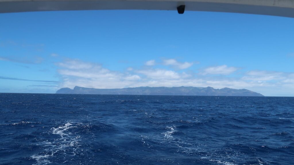
It was time to say goodbye to St. Helena, climb back on my boat, and start sailing northwest. As I watched the island recede over the horizon, I felt sentimental and a bit sad that this voyage was coming to end even though there are still several thousand miles left to sail. From the early planning in 2020, to starting to sail in 2022, until now, if feels like I didn’t savor all the moments enough, that they quickly slipped by. I hope when I write the book about this voyage I can re-capture their fleeting intensity and enduring impact on how I’ve experienced the world.

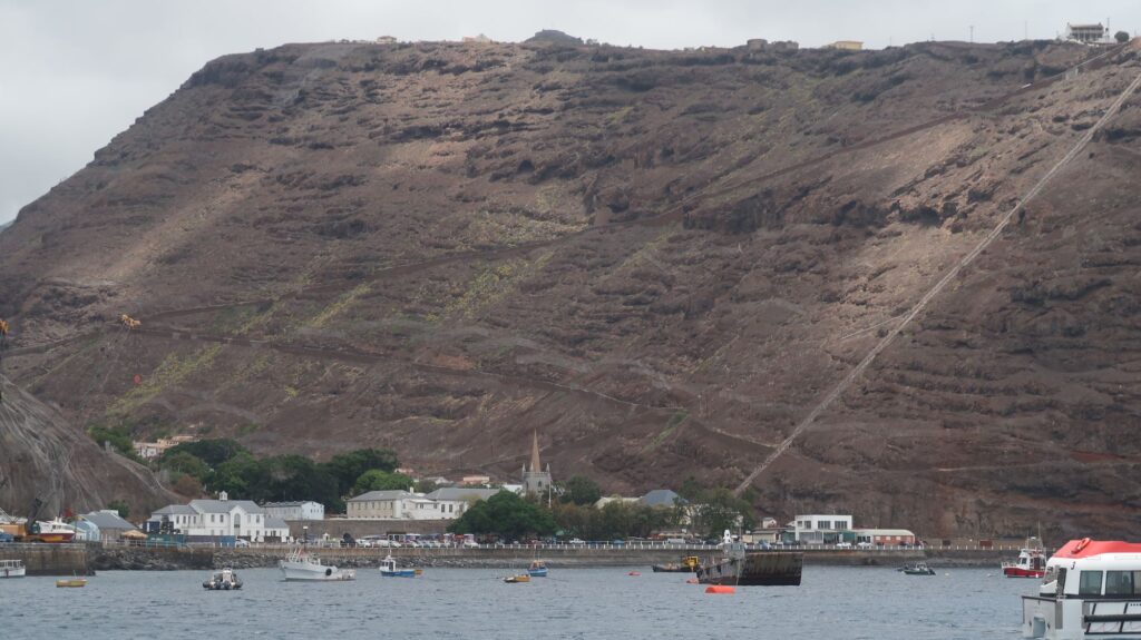
Jamestown from my anchorage. Jacob’s ladder with 699 steep steps in on the right.
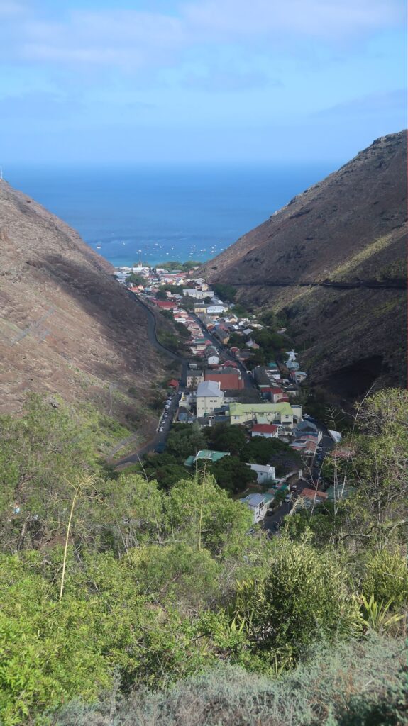
Jamestown nestled in the valley between 2 mountainsides
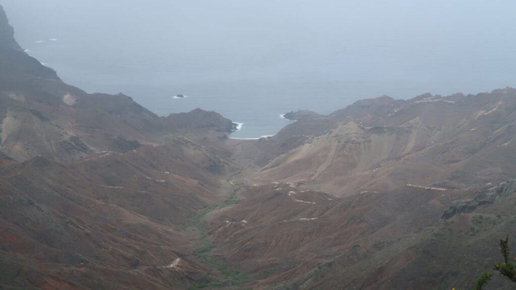
Sandy Bay on the east side of the island
Jonathan the tortoise – 196 years old!
The little ferry boat that picks up sailors from their anchored yachts and takes them to shore
Main street in Jamestown
Longwood house where Napoleon spent his exile
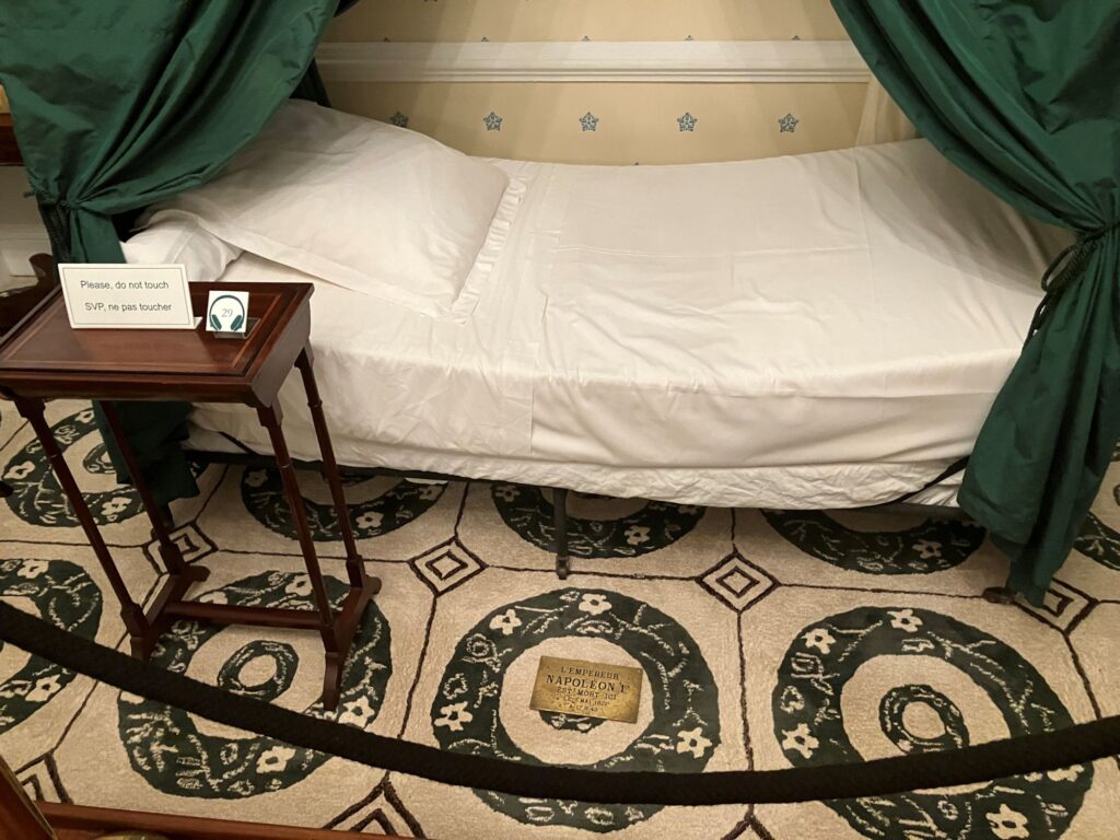
Napoleon’s death bed
Napoleon’s now empty tomb
Phywave anchored in James Bay with 3 other visiting yachts
St. Helena receding over the horizon